Pre-FVVP History of Van Vorst Park
In 1835, Cornelius Van Vorst deeded a 1.8 acre parcel of his land to become what is now Van Vorst Park. A short while later, in 1851, Van Vorst Park was landscaped into a formal City Park by Peter Henderson. The surrounding streets, sidewalks, stylish town houses, and row houses were created around Van Vorst Park with an unprecedented explosion of urban development. At the same time that this park became the vortex for the Van Vorst community’s urban development, John B. Coles did the same for 4.6 acre Hamilton Park (a dozen blocks north of Van Vorst Park) and the stylish townhouses and brownstones that soon surrounded it.
For many centuries before the arrival of European settlers, the Lenne Lenape Indians had viewed this landscape as they fished for shad, striped bass, and many other fish; and gathered oysters, crabs and other sea life. They also enjoyed the fertility of this unique soil as they harvested certain plants such as blackberries, strawberries, raspberries; and many types of herbs. This was a unique climate, which stayed warmer over the winter due to the nearby ocean and Gulf Stream. Traveling west from Paulus Hook, one travelled over what at high tide was water and marshland until one reached the vicinity of what is now Grove Street which is one block east of today’s Van Vorst Park. West of Grove Street, the land was increasingly more solid except during storms and very high tides. To be securely dry, one needed to continue further west up the hill (Bergen Hill) on whose summit the old Jersey City Medical Center (now Beacon Hill Condominiums) rests. Between elevated Paulus Hook and Bergen Hill, this in between land of marshes, meadows and waterways (from near the current Hoboken border, south to near current Communipaw Avenue) made up a big part of what came to be known as “Harsimus”, which may be derived from “ahasimus” which means “sacred burial ground” in the language of the Lenne Lanape Indians. Similarly, in their language “Communipaw” means “public walking path.”
During the 1600’s, the Dutch gradually took all this land from the Indians and used it for farming and fishing. The Van Vorst family members were the prominent landowners in this area in the 1630’s; and by 1698 Cornelius Van Vorst owned all the land between Bergen Hill and the Hudson River (from near the current Hoboken border to near Communipaw Avenue). The Van Vorst farm house was near Henderson and 4th Street (about 10 blocks northeast of Van Vorst Park). In 1804, Van Vorst transferred land rights for Paulus Hook to Anthony Dey and Van Vorst’s holdings were now “limited to” Harsimus: the land between Paulus Hook and Bergen Hill.
From the 1840’s on, we can see the rapid transformation of the Harsimus area from rural farming and fishing to industrial and urban development with the railroad playing an enormous role. The history chart that follows this essay will highlight some of the key events of this transformation of Jersey City, of Van Vorst Park and of the Van Vorst community. But first one last geographical note. The land surrounding Van Vorst Park is quite different today. For example, two streams including Mill Creek used to meander from the Hudson River near Hoboken, inland to near Bergen Hill, passing 5 blocks west and south of Van Vorst Park’s future site, as it emptied into Communipaw Cove (near Communipaw Avenue). Many farmers throughout the 1700’s would use Mill Creek to bring their grain to and from Pryor’s Mill and also to transport their goods for sale.
By 1836, the famous Morris Canal, which provided important westward transportation, passed five blocks south of Van Vorst Park. The mouth of this canal still exists on the Hudson River shore at Peninsula Park at the Northern border of Liberty State Park. Finally, there was a creek that came from the Hudson River westward where Columbus Avenue is today up to Grove Street (a point three blocks north and one east of Van Vorst Park). In the early 1800’s, fisherman (especially of shad) would sail up this creek and sell their goods at Grove and Newark Turnpike (now Newark Avenue). Students attending school in Paulus Hook might, at the end of the day, go for a swim in this still pure creek. Since the early 1700’s, Newark Turnpike was the one main road westward beyond the marshes, up Bergen Hill and ultimately on to the City of Newark.
On the Historical Flow Chart that follows this essay, we will view a number of historical events occurring soon before, soon after, or at the same time as the 1835 deeding of Van Vorst Park and the 1851 landscaping of this Park. If you look at the flow of these events, you’ll see the end of a pristine era of agriculture and fishing to an abrupt beginning of the industrialization and urbanization of Jersey City. The creeks, waterways and marshland are filled in, often by the railroads. Where marsh and water had been, tracks and City streetscapes rapidly spring up in the mid-1800’s, including ornate townhouses and brownstones. This railroad-driven urbanization begins in earnest around 1840 and is nearing completion by 1870.
Between the 1835 deeding of Van Vorst Park and 1870, a mere 35 years, the land surrounding Van Vorst Park changed from pristine marshland, meadows, waterways and farmland to rows and streets of elegant townhouses and brownstones, stylish gas streetlights, bluestone sidewalks and cobblestone streets. Nearly all the buildings you see surrounding this Park today were built in the 1850’s and 1860’s. In other words, they were built just before or after the Civil War. In 1848, the population of Jersey City was 3,602. A mere twelve years later in 1860, the population has begun to swell to 29,226. In amazing fashion, we can see a City’s infrastructure and population being born within a single generation. Van Vorst Park enjoys the company of two other historic parks. One is “cousin” Hamilton Park (also in Harsimus); and the second is “grandparent” Four Corners Park in older Paulus Hook. These three parks, and especially the buildings and streets surrounding them define the core of Jersey City’s earliest urban history, and the best-preserved record of Jersey City’s early greatness.
The economic fuel of Jersey City’s urban birth was industry and the railroads. By the 1950’s and 1960’s, industry was leaving Jersey City and the railroads were on the decline, in part, due to the airline industry. Jersey City began to deteriorate, as it awaited a new economic fuel. The new economic energy emanated from the “second wall street” that sprung up mostly along the Hudson River beginning in the early 1980’s and accelerating over time. In less than twenty years, miles of decaying piers, railroad yards and lines along the waterfront have given birth to dozens of modern office buildings, thousands of new residential units and towers, and rapid infrastructure and population growth in the surrounding area. Before anyone should count the railroad industry out, the newly created Light Rail System is an important part of our new infrastructure, as is the already existing PATH system with which it is coordinated. Though beyond the scope of this essay, there is also much current development going on in Jersey City’s other wards.
Perhaps we are in the midst of another abrupt urban development explosion today, which is comparable to the first one between 1835 and 1870. If so, one needs to look further than “economic fuel” to understand our City’s birth; or its rebirth. During its first urban birth, the Van Vorst community (and the rest of Jersey City) enjoyed the influx of tens of thousands of immigrants, mostly from Europe, whose dreams, skills and hard work helped build our City. Many Jersey City residents of that era returned from the Civil War where they fought for a unified nation. Many of our community’s neighbors were full of spirit and community-mindedness. How could one not care about a community that you’ve watched be born and that you’ve helped to take its first steps? The early residents of the Van Vorst community ran the spectrum from skilled laborers, to businessmen, professionals as well as celebrities and statesmen. But most shared in common their wish for their community and for Jersey City to be truly great.
VAN VORST PARK’S HISTORICAL FLOW CHART
Before 1800
The Lenne Lenape Indians of the Delaware tribe fished, hunted, harvested, lived in this protected environment, shielded by the palisades, and warmed by the Gulf Stream.
1802
Regular ferry service from Harsimus to New York City begins. Increasingly, Jersey City transported passengers and cargo between New York City and the rest of the United States. In the beginning, this was done by boats and stage coaches; by the 1840’s, it was by ferries and railroads. For New York City and for much of the United States, Jersey City became the “gateway to America.”
1803
Ferry service from Paulus Hook to New York City starts. Ferry House is built nine blocks due east of what will be Van Vorst park on York Street at the Hudson River, with a nearby hotel, stable, and stage coach stop.
1820
Jersey City within Bergen County is incorporated.
1824
Drummer’s glass factory opens.
1825
Rouse & Turner pottery factory opens.
1829
Population of Jersey City is 1,357.
1834
Federal “resolution” of New York vs. New Jersey territory dispute frees up Jersey City’s shoreline for development after 30 years of paralysis.
Railroads begin to run; construction proceeds at an incredible pace. The railroads begin to fill in large areas of marshland and waterways.
1835
Cornelius Van Vorst deeds 1.8 acres of his estate for use as a public park.
1836
Morris Canal completed through Jersey City to the Hudson River.
Harsimus and Jersey City become independent from the control of Bergen Township. First mayor of Jersey City is Dudley S. Gregory. Jersey City declares its eastern boundary to be the middle of the Hudson River!
1839
Beginning of boom years for grading and building streetscapes, and laying the groundwork for future downtown development. Public spirit soars.
1841
Township of Van Vorst established. More than half the land is still used for farming.
1843
First bank opens: Provident Institution for Savings.
1844
Within a dozen blocks north and east of Van Vorst Park, three public water pumps are created as private fresh water wells are becoming contaminated by high tides and poor drainage.
1845
First streetlamps (gas) are installed. The first lamp is installed at what is now Grove Street and Columbus.
Atlas Foundry opens.
1846
Slater & Steele foundry opens.
1847
First fire engine purchased and first firehouse built: Washington Fire Engine Company.
Cunard Steamship piers built.
Dixon Crucible (Dixon Mills) Company built.
1848
Jersey City population is 3,602.
Cobb & Field’s foundry opens.
Expanded railroad lines run more effectively, and become better coordinated with the ferries. Ferry boats run more quickly, run more often, and now run at night.
1849
Jersey City population is 4,166.
Sanitation become organized
The Colgate Soap Works was built at the foot of York Street. Many streets, sidewalks and row homes go up around it.
Hamilton Park is landscaped. Surrounding streets and homes begin to be built at a fast pace.
1850
Jersey City population is 11,473.
First police force.
Sixty streetlights are installed. They’re lit when the moon isn’t near full.
1851
Van Vorst Township joins with Paulus Hook. At this early moment of its history, Jersey City’s boundaries were roughly the ones of today’s “Downtown Ward”.
Jersey City’s population is about 12,000.
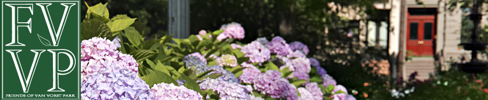
Van Vorst Park is landscaped by Peter Henderson (of Henderson’s Seed Co.). Surrounding streets and homes begin to be built at a rapid pace.
1852
159 new street lamps are installed.
1854
Water reservoir in the Heights takes pure water from the Passaic River and distributes it throughout Jersey City. Parades from Paulus Hook to the Heights and festivities joyously spread throughout the City for a full day.
1855
Jersey City population is 21,755.
1860
Jersey City population is 29,226. An economic boom is happening.
Abraham Lincoln passes through Jersey City on his way to his inauguration. He transfers from a ferry to a train (with, among others, Jersey City Mayor Cornelius Van Vorst).
1861
Bergen Arches are completed. A tunnel trough Bergen Hill now creates a direct connection from the Jersey City docks west. Besides accelerating business growth and development, this project nearly completes the railroad industry’s quarter century of filling in Harsimus marshland with land fill.
1869
Bergen and Hudson City (in the Heights) become part of Jersey City.
1873
Greenville becomes part of Jersey City. The City’s geographic expansion is just about complete.
1896
City Hall is built on block east of Van Vorst Park.
1899
The Main Branch of the Jersey City Public Library is built over looking Van Vorst Park.
1904
Increasingly, industry polluted the Passaic River, thus contaminating Jersey City’s water supply (eventually contributing to cases of typhoid). Jersey City purchases water supplies from the Rockaway River at Boonton and creates 22 miles of pipeline to supply Jersey City.
* * * * *